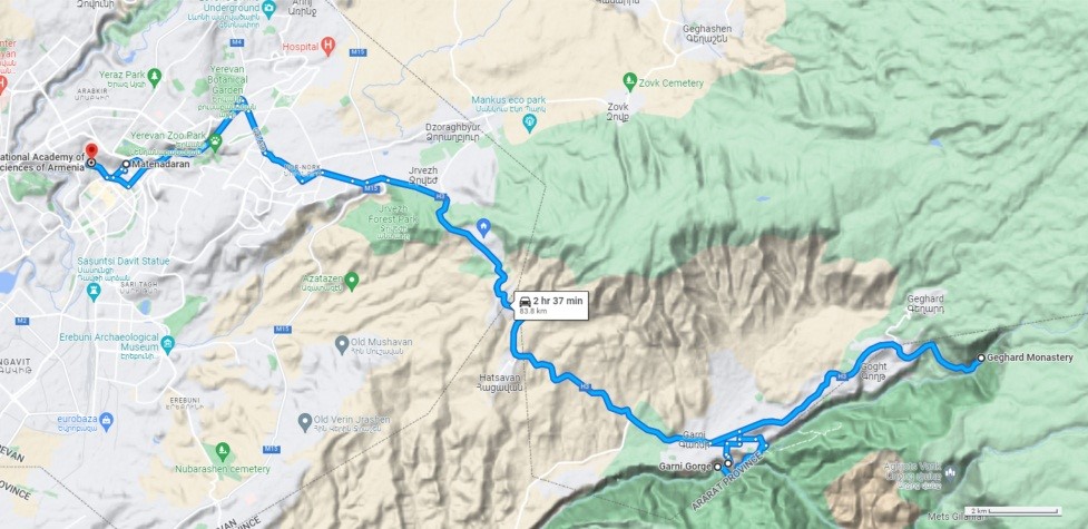
MID-CONFERENCE EXCURSION DAY 1, SEPTEMBER 06
- Matenadaran – Scientific Research Institute of Ancient Manuscripts
- Garni Hellenistic Temple and Fortress
- Azat River Canyon and thick columnar joint lava flows
- Geghard Monastery and thick volcanoclastic suite
- Return to Yerevan
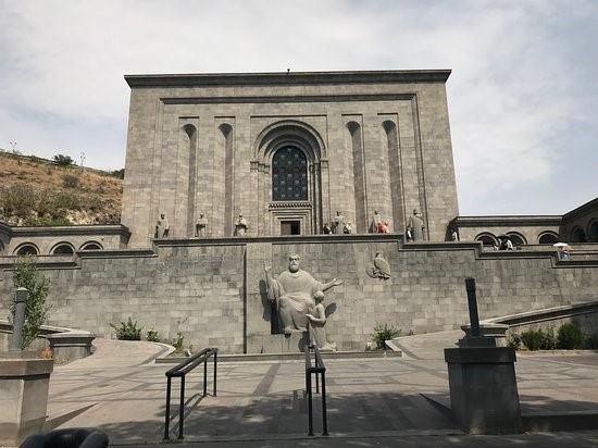
First, we will visit Mesrop Mashtots Matenadaran, a repository of ancient manuscripts, a research institute and a museum in Yerevan. It holds one of the world’s richest depositories of medieval manuscripts and books which span a broad range of subjects, including history, philosophy, medicine, literature, art history and cosmography in Armenian and many other languages (Figure 2).
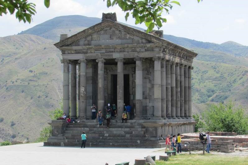
Afterwards we will visit Garni Fortress and the 1st century AD Classical Hellenistic Temple of Garni. It is located 28 km away from Yerevan. The fortification at Garni was a summer residence of the kings and the place where their troops were stationed. The structures of Garni combine elements of Hellenistic and national culture, which is evidence of antique influences and the distinctive building traditions of the Armenian people (Figure 3).
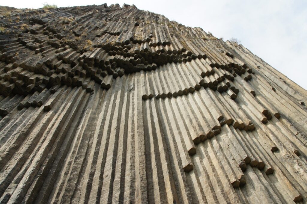
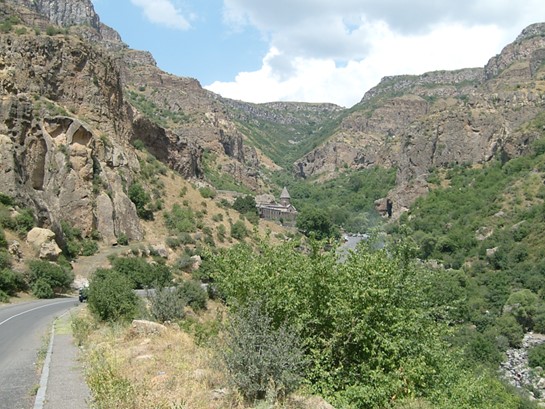
Then the buses will take a route to the Azat River’s spectacular gorge, located a short distance from the temple, and see spectacular columnar joints lava flow (dated 127 Ka years), and Garni active fault. The source of the lava flow is within Gegham volcanic upland. Hexagonal prisms formed in the canyon are related to the slow cooling and cracking of lava flow in Armenia. It got the name “Symphony of stone” and is recognized as a geological monument. (Figure 4).
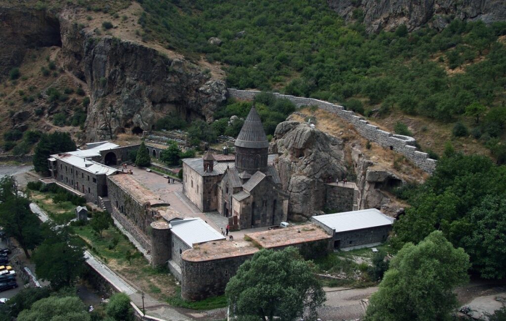
After lunch, we will visit the 4th-13th Century AD Geghard Monastery and view of Vokhchaberd volcanoclastic suite of the Upper-Miocene-Pliocene Age. The monastery complex was founded in the 4th century by Gregory the Illuminator at the site of a sacred spring inside a cave. Garni and Geghard are located at the foothills of the Gegham volcanic ridge’s foothills in central Armenia(Figures 4, 5 and 6).
MID-CONFERENCE EXCURSION DAY 2, SEPTEMBER 08
- Aragats volcano and the Armenian ignimbrites (650 Ka)
- Amberd historical fortress
- Irind volcano and unique Plinian eruption section
- Arteni rhyolite volcano (1.5 Ma)
- Barozh mid-late Paleolithic open air site and obsidian workshop
- Return to Yerevan
Aragats volcano and Armenian Ignimbrites
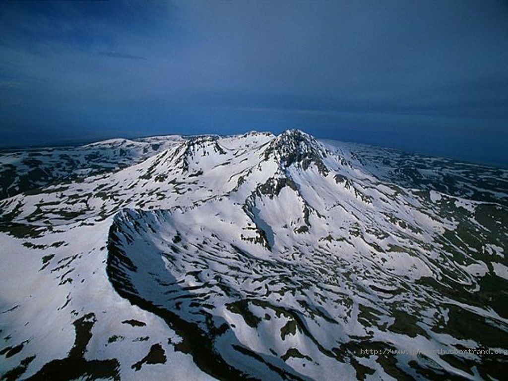
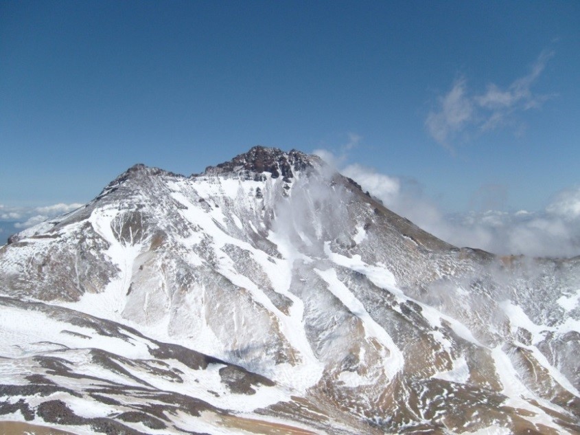
A short stop at the foothills of Quaternary Aragats volcano. Aragats (4090m, Figures 8, 9) is one the largest volcanoes in the entire region and produced central vent (inc. Plinian VEI ≥ 5) and monogenetic type flank eruptions and periphery plateaus within a total area greater than 5000 km2, known as Aragats volcanic province (AVP). The Aragats volcanic province (AVP) comprises the composite cone of Aragats volcano, the peak of which is built on a summit plateau, ~45 km in diameter shield structure with dozens of flank vents, scattered monogenetic cinder cones on the adjacent volcanic plateaus as well as the neighboring stratovolcano Arailer.
The vast fields of lava flows, ranging in composition from basalts to dacites and ignimbrite forming Plinian eruptions in Armenia are related to Aragats volcano (Figure 10). New K-Ar and 40Ar/39Ar age determinations of groundmass and separated plagioclase samples indicate that volcanism at AVP began ~2.5 Ma, while the most recent volcanic activity is 0.49 Ma for Plinian eruption of trachydacites from Irind flank vent and basaltic trachyandesite lava flows from Tirinkatar (0.48-0.61Ma), Kakavasar, (0.52-0.54Ma) and Ashtarak (0.58 Ma) monogenetic flank centers, as well as trachyandesites of Jrbazhan volcano on the summit plateau of Aragats (0.52 Ma). The activity of Aragats stratovolcano itself is estimated to be around 1 Ma, between 1.54 Ma to ~0.5Ma.
Amberd historical fortress
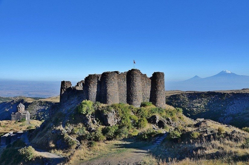
Amberd, a medieval fortress in Armenia (Figure 11), is located on the southern slopes of Mount Aragats, on a triangular cape where the rivers Arkashen and Amberd join. Amberd means “a fortress in the clouds,” a fitting name considering its elevation at 2 300 m above sea level. The mansion and some sections of the walls were constructed in the 7th century by the noble house of Kamsarakan. The site incorporates a rich variety of buildings including a church, a chapel, baths, walls and several gates.
Irind volcano Plinian eruption section
Irind vent is located on the slopes of Aragats stratovolcano. Following the pyroclastic Plinian style VEI=4 eruption, produced ~13 m thick Plinian pumice fall deposit (Figures 12 and 13) with overlaying ignimbrite, a voluminous (2.9-3.6 km3) effusive eruption of Irind created up to 120 m thick trachydacite lava flows that extended 18 km from the vent demonstrates relatively low viscosity of Irind magma, since such long and thick lava flows are not typical for viscous felsic lavas. The Irind eruption products are characterized by a plagioclase-two pyroxene mineral association that is atypical for Aragats. Our results support the view that often small eruptive vents (Irind) on the slopes of large coeval stratovolcanoes (Aragats) are not necessarily tapping the voluminous magma mushes underneath and are capable to deliver independent Plinian eruptions. The compositional differences between the volcanic products of the Irind cone compared to the main volcanic edifice of Aragats suggests that these are triggered by intrusions of hot, volatile-rich and alkaline felsic magmas that did not mix well with the otherwise dominant and older magmatic system under Aragats.
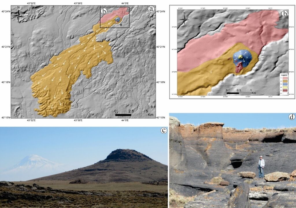
Explosive Sub Plinian phase, 2. Effusive phase, 3. The contour of Irind volcano, 4. Trachydacite dome (plug) of Irind volcano, 5. Lavas from a system of cracks. White arrows show directions of lava flows (c) Photograph of the vent/plug of Irind volcano with Ararat stratovolcano in the background (in white). (d) Black-reddish column-collapse vitrophyre outcropping on the western flank of Irind volcano.
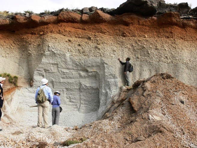
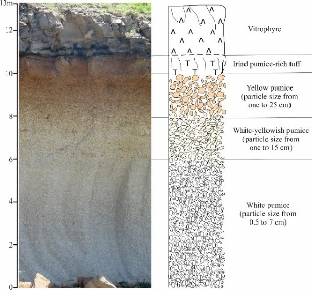
Figure 13. Plinian pumice fall and ignimbrite cover (left); Plinian fall deposit section (right)
Arteni rhyolite (obsidian) volcano
Arteni volcanic complex (Figures 14, 15) is located within Aragats volcanic province; the age of Arteni rhyolites considered to be early Pleistocene, K-Ar ages yielded: for Mets Arteni 1.45-1.5 Ma (Chernishev et al., 2002), fission tracks (1.27 Ma; Oddone et al., 1999) and 1,26 Ma for Pokr Arteni (Lebedev et al., 2011). Thus, rhyolitic eruptions and the formation of domes of Arteni volcano correspond to the Early Pleistocene. Eruption products of Arteni volcano are covered by more recent middle Pleistocene andesitic lava flows of neighboring Kabakhler cinder cone and ignimbrites of Aragats stratovolcano.
Arteni is the most compound rhyolitic volcanic complex in Armenia and consists of two independent rhyolitic volcanoes: Mets (Big) and Pokr (Little) Arteni (2047 and 1754 m asl, respectively). Volcanic activity began with an eruption of perlite-pumice pyroclastics, followed by eruptions of detrital perlite and zonal obsidian that flowed westward and southward; shorter flows also went northward (Fig. 15). Arteni obsidian is of high quality; “smoky quartz” of the translucent, reddish-brown, black, and other varieties is known, see (Karapetyan (1972) for details.
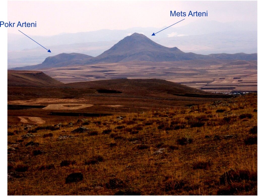
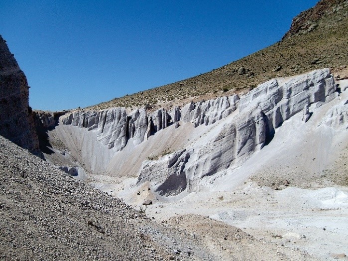
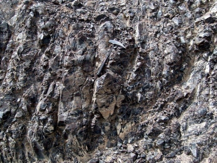
Figure 15. Products of explosive eruptions of rhyolite pumice and perlite pyroclastics (left). Obsidian cliff in small modern quarry across a lava flow erupted from Pokr Arteni volcano (right)
Barozh Middle Paleolithic open air site and obsidian workshop
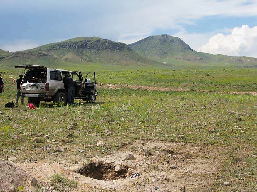
The newly discovered site of Barozh 12 open air Middle Paleolithic site was studied recently by the international archaeological team, summarized in Glauberman et al., (2013). It is located in western Armenia, near Arteni volcano (figure 16). The site yielded significant data on Late Middle Paleolithic technology, land use, and lithic economy in a region that has heretofore been little explored. The lithic assemblage appears similar to those from other later Middle Palaeolithic sites in the region and could date to the time range when archaic and anatomically modern species populations overlapped temporally and/or geographically. Barozh 12 is a large, high-density Middle Paleolithic site. The surface of a 1m×1m unit, and a 0.50m × 0.50m × 0.95m deep test trench yielded 1174 artifacts. Based on preliminary analysis of samples from the surface (n = 102) and excavated artifact assemblages (n = 340), both display typo-technological characteristics of the Middle Palaeolithic in the region. Both discoidal and triangular Levallois core reduction is observed on discarded cores and flakes, as are numerous retouched pieces, predominantly classified as points, blades, and a variety of unifacial scrapers. Surface and excavated artifacts are of all size classes and technological categories, including tool re-sharpening flakes and core trimming elements. Artifacts class frequencies and cortex analysis also suggest that all stages of core reduction and tool use, maintenance and discard occurred on site. Preliminary results of portable X-Ray fluorescence (pXRF) on a small sample of obsidian artifacts (mainly retouched pieces) indicate that most were manufactured from local (1-2km) Pokr and Mets Arteni material, while a smaller number of artifacts were manufactured on material that originates from 80km –>100km away. Varying frequencies of local and ‘imported’ raw materials observed in small samples from stratified archaeological levels suggest dynamic raw material transport patterns over time.
The extent of a ‘raw material exploitation territory’ is suggested by obsidian sourcing though only to the east of the site. Further pXRF study of obsidian raw materials in conjunction with further analysis of artifact manufacture and discard patterns, will elucidate regional-scale technological and land use behavior. These first results of survey, lithic assemblage analysis, and test excavation indicate that Barozh 12 was frequently reoccupied over time for a variety of uses, and may be considered a ‘central place’ in the regional settlement and mobility system.
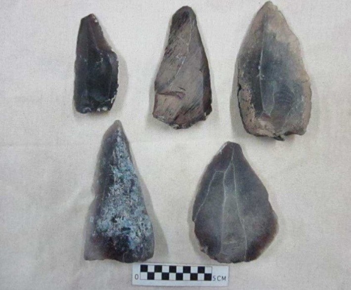
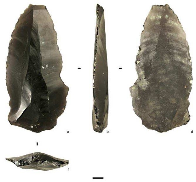
Figure 17. Artifacts from the test trench at Barozh12 (after Glauberman et al., 2013)
POST-CONFERENCE EXCURSIONS SEPTEMBER 09-11
Detailed information about the post-conference field trips will be provided in the second circular.
POST-CONFERENCE EXCURSION DAY 1, SEPTEMBER 09
- Shamiram volcanic plateau
- Shamiram and Karmratar volcanoes
- Yerevan ignimbrites and Artik “lava-like” ignimbrites
- Harichavank monastery
- Return to Yerevan
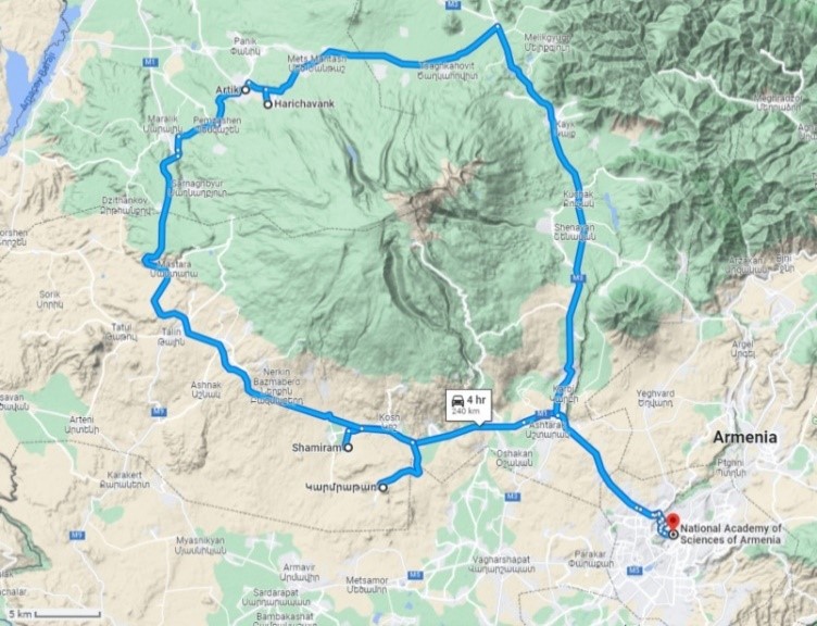
Figure 2.1. Post-conference trip route, day 1
Shamiram volcanic plateau
The Shamiram plateau occupies the southern periphery of the Aragats volcano, where the topography changes from gentle slopes to the flat relief of the Ararat basin.
The Shamiram Plateau is of volcanic origin and is formed by thick sequences of lava flows and ignimbrites. 16 cinder cones with lateral vents and two maar-like structures reflect a long history of monogenic volcanism that eventually created the plateau itself between ~1.54-0.64 Ma. Of particular interest regarding the geology, volcanology, and stratigraphy of the Shamiram Plateau is the location of the Armenian Nuclear power plant (ANPP) site, directly next to the southern edge of the Shamiram Plateau, and near the volcanoes of the Dashtakar group, where lavas are covered by lacustrine deposits of the Ararat Depression.
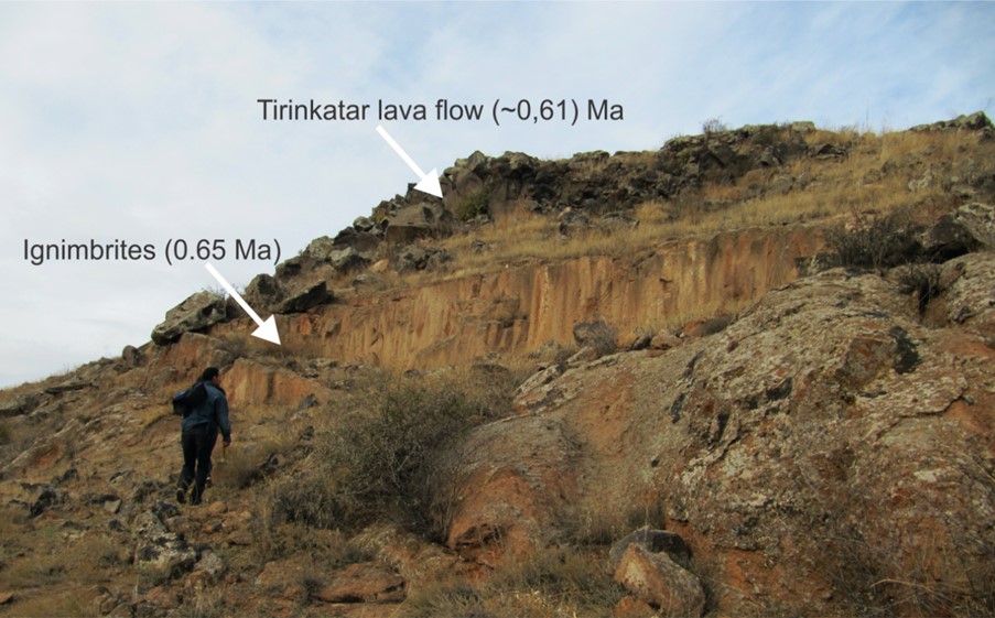
The cinder cones on the Shamiram plateau have been grouped into 5 separate clusters, namely: Shamiram, Karmratar, Blrashark, Dashtakar, Atomakhumb. The northern slopes of Shamiram, Karmratar, Atomakhumb, and Blashark cones (850-750 Ka), oriented towards Aragats stratovolcano, are covered by ignimbrites, (655 Ka, 40Ar/39Ar). While Dashtakar cones are younger and belong to post-ignimbrite stage of volcanism of the Aragats volcanic province (647 Ka, 40Ar/39Ar). Data from wells drilled at the ANPP site show that Miocene sedimentary formations are located at the base of the plateau, at a depth of ∼360-393 m from the surface. According to the results of 40Ar/39Ar dating, the oldest lava flow from borehole 3NA is dated at 1.54±0.024 Ka, that probably belongs to yearly stages of activity of Aragats. The youngest lava flow found on the Shamiram plateau is the 22 km long Tirinkatar lava flow, 0.614±0.019 Ma, originated from a side vent on the slopes of Aragats.
Ignimbrites are also found inside the craters of Shamiram, Karmratar and two other Atomahumb cinder cones. Figure 2.2 shows the presence of ignimbrites in the crater of the Kamratar volcano cinder cone, reaching a height of 140 m above the base, which indicates the high kinetic energy of the pyroclastic flow and it’s ability to override topographic barriers, since immediately after the cone ignimbrite cover continues.
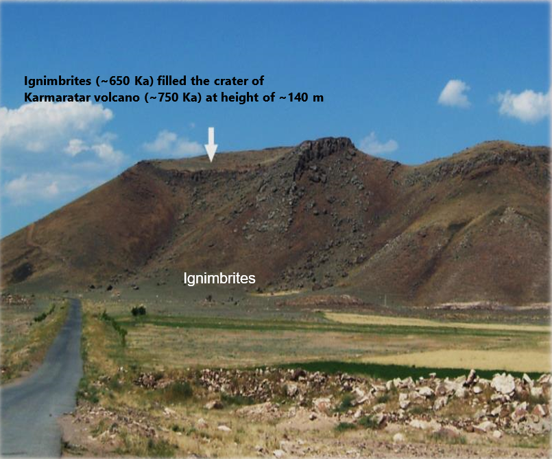
Figure 2.2. Karmaratar volcano with crater filled by ignimbrites
Harichavank monastery
The peculiarity of Haritchavank Monastery is that large stones (Artik-type strongly welded ignimbrite, 0.71 Ma) of different shades were used for its construction (Fig. 2.3). Multicolored elements create a unique pattern on the walls of the building. Harichavank is one of the most famous monastic centers in Armenia and it was especially renowned for its school and scriptorium. The oldest part of this Armenian monastery is the Church of St. Gregory the Illuminator; it is a domed structure that is usually placed in the category of so-called “Mastara-style” churches. The founding date of the monastery is unknown, but probably it was built no later than the 7th century, when the St. Gregory church was erected.
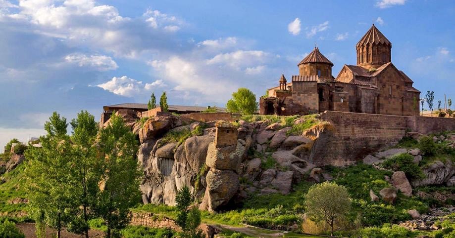
Figure 2.3. Harichavank monastery build of strongly welded Artik-type ignimbrites (0.71 ma) and a cliff by same ignimbrite.
POST-CONFERENCE EXCURSION DAY 2, SEPTEMBER 10
- Nor Geghi Mid-Paleolithic site (400-200 Ka).
- Gutansar volcano
- Sevan peninsula, Sevanavank monastery
- Stay in Martuni
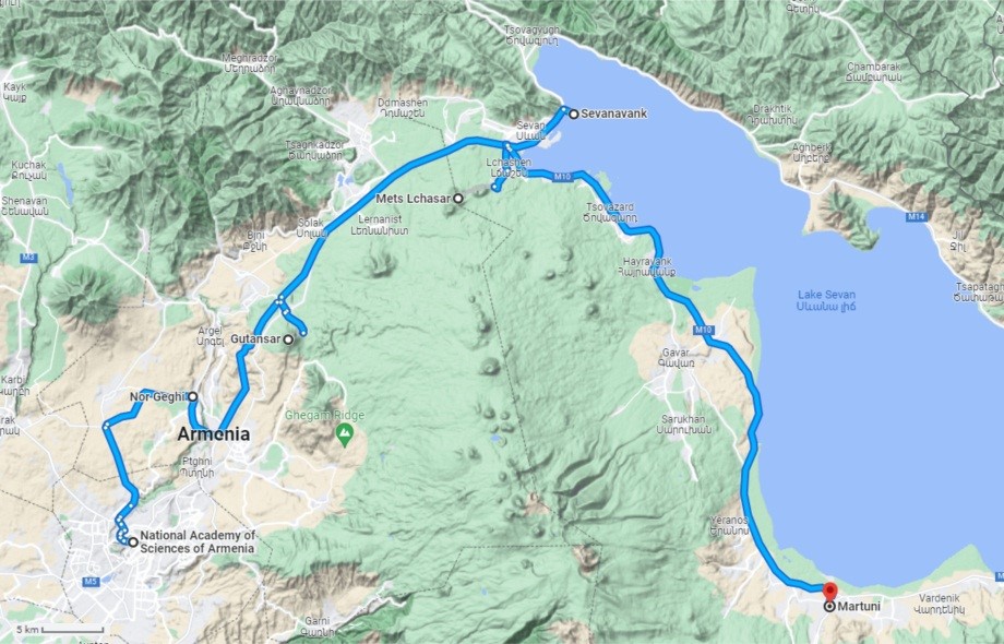
Figure 2.4. Post-conference trip route, day 2
Nor Geghi-1 Lower to Middle Paleolithic site
The Nor-Geghi-1 site is located in the canyon of the Hrasdan river, and marks the Lower to Middle Paleolithic transition (~400,000 to 200,000 years BC). The site contains dated sections of lava flows, volcanic ash and paleosols with tools (Fig. 2.5). It was studied by an international archaeological team, whose research is summarized in Adler et al., (2014).
The Lower to Middle Paleolithic transition (~400,000 to 200,000 years ago) is marked by technical, behavioral, and anatomical changes among hominin populations throughout Africa and Eurasia. The replacement of bifacial stone tools, such as handaxes, by tools made on flakes detached from Levallois cores documents the most important conceptual shift in stone tool production strategies since the advent of bifacial technology more than one million years earlier and has been argued to result from the expansion of archaic Homo sapiens out of Africa. Data from Nor Geghi 1, Armenia, record the earliest synchronous use of bifacial and Levallois technology outside Africa and are consistent with the hypothesis that this transition occurred independently within geographically dispersed, technologically precocious hominin populations with a shared technological ancestry. The archaeology of Nor Geghi-1 is contained within alluvial sediments sandwiched between an upper (Basalt 1) and a lower (Basalt 7) lava flow (Fig. 2.6). The 40Ar/39Ar technique was used to date Basalt 7 (441 ± 6 ka) and Basalt 1 (197 ± 7ka) thereby bracketing the stratified alluvial sediments between late OIS 12 and the end of OIS 7 (Fig. 2.7). The five stratigraphic units recorded between the basalts (from bottom to top, Units 5 to 1) form a normally bedded sequence of fine-grained sedimentary beds, with minor sands and gravels toward the base.
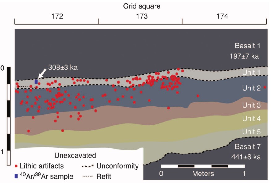
Figure 2.5. Representative stratigraphic section at Nor Geghi-1 site (after Adler et al., 2013)
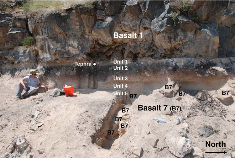
Figure 2.6. The northern area of excavation illustrating the locations of Basalts 1 and 7, the 40Ar/39Ar-dated tephra sample from Unit 1, and Units 5–1 (after Adler et al., 2013).
Gutansar volcano
The Gutansar volcanic complex, located near the Hrazdan Gorge, represents a bi-modal volcanic system: rhyolitic dome cut by basaltic-andesite cinder cone. It is one of the most archaeologically important obsidian sources in the South Caucasus. Gutansar volcano is shown in Figure 2.7. The activity of Gutansar began with eruptions of rhyolitic pyroclastic material followed by rhyolitic flows and obsidians, (Fig. 2.8) and ended with quite lengthy flows of rhyolitic and dacitic lava, the final portions of which plugged the volcano channels and formed typical dome-shaped structures. In the late Middle Pleistocene (~200 Ka), the volcano was cut by other volcanoes of andesite and basaltic andesite composition (Fig. 2.9), which erupted extended lava flows. A large crater (600 m in diameter, 5-8 m deep) formed on the Gutansar summit during the Late Pleistocene. The Large rhyolite-obsidian Extrusion (Djraber extrusion) occupies an area between the villages of Fantan, Gyumush (Karenis), Djraber, and Charentsavan city.
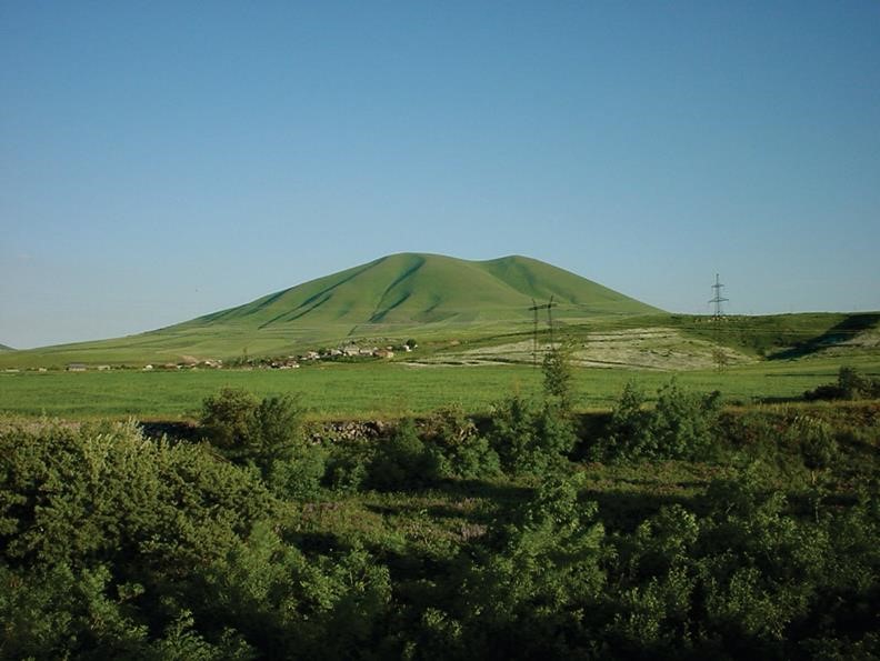
Figure 2.7. Gutansar volcano, Gegham volcanic upland.
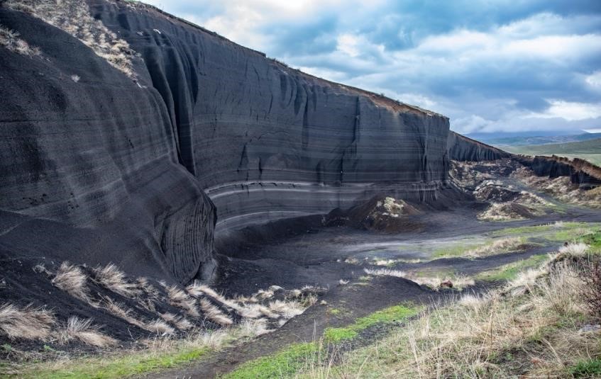
Figure 2.8. Scoria open pit on the slopes of Gutansar volcano (photo by Tigran Amaryan)
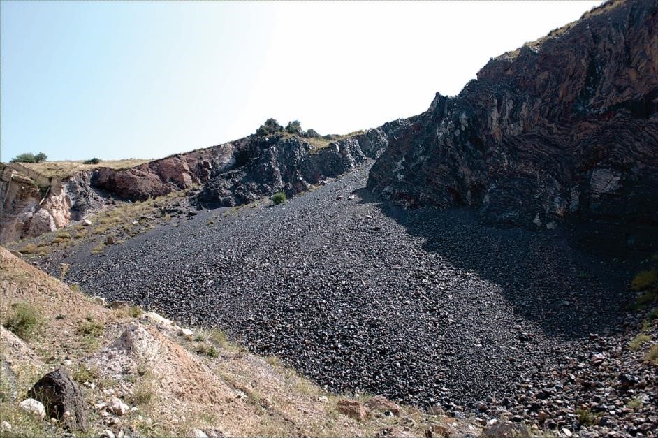
Figure 2.9. Jraber extrusive body related to the Gutansar volcanic complex. Obsidian outcrop near the Yerevan-Sevan highway.
Lake Sevan.
Lake Sevan is the largest freshwater lake in Armenia and the entire western Asia region (Fig. 2.10). The altitude of the lake is ~1900 m. The geology of the lake and its surroundings represent an interesting combination of Quaternary and Holocene tectonics and volcanism. The area of the lake is ~1241 km2, with a watershed of 4891 km2. The northern part of the lake is named the Lesser Sevan and has the greatest depth (83 m). The southern part, or the Greater Sevan, is twice as large as the Lesser Sevan, but it is only up to 30 m deep.
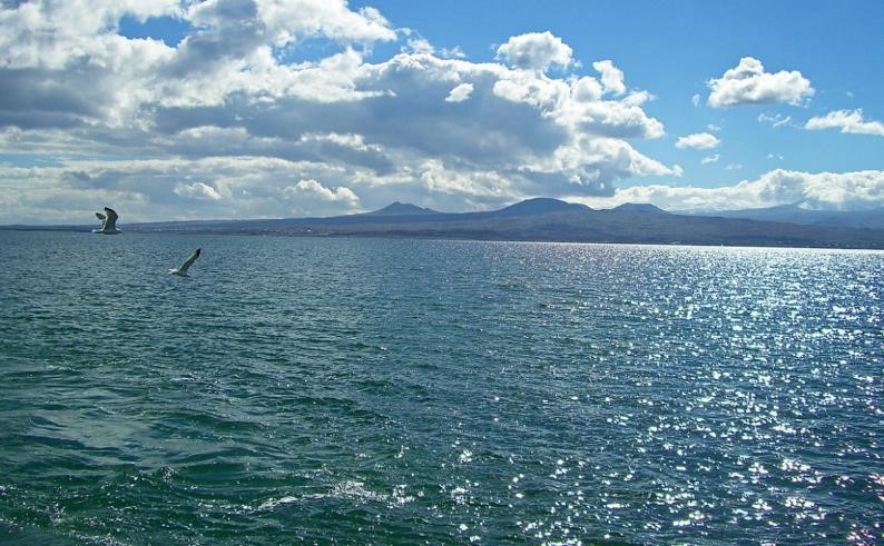
Figure 2.10. Lake Sevan with volcanoes of Gegham highland in the background
Geologically, the northeastern shore of Lake Sevan is characterized by the occurrence of an ophiolitic suture of Middle Jurassic to Early Cretaceous age that corresponds to the structural boundary between the periphery of Eurasia and the South Armenian block (Galoyan et al., 2009; Sosson et al., 2010; Asatryan et al., 2010). The continental collision occurred to the north of the South Armenian block during the Paleocene (Sosson et al., 2010).
The Gegham volcanic upland in central Armenia, located south of Lake Sevan is a typical example of monogenetic volcanism in Armenia and is presented morphologically by an elongated oval shield. The highest point of the Gegham upland, among 127 known volcanic centers, is Azhdahak volcano, 3597 m. The period of activity of the Gegham volcanic upland ranged from Late Miocene (Baghdasaryan & Ghukasyan, 1985) until the Holocene (Karakhanyan et al., 2003). Within the upland, Late Pliocene-Quaternary volcanic activity is represented by volcanic products erupted from monogenic centers varying in composition form trachybasalts, baslatic-trachyandesites,- trachyandesites to trachytes trachydacites and trachyrhyolites, (Jrbashyan et al., 2007).
The right-lateral strike-slip Pambak-Sevan-Syunik fault system, described in the next section, branches into two segments near the northern shore of the lake. One of the segments, PSSF-2, stretches along the northeastern shore of the lake and south of the thrusts associated with the ophiolitic suture. The second segment, PSSF-3, stretches across the lake floor and emerges on its southeastern shore. The western shore of the lake is framed by the N-S-striking system of the normal Gavaraghet faults defining horst and graben structures (Fig. 2.11). The volcanic ridges of Gheham and Vardenis, including many centers of Quaternary monogenetic volcanism, represent the western and southern boundaries of the Lake Sevan basin.
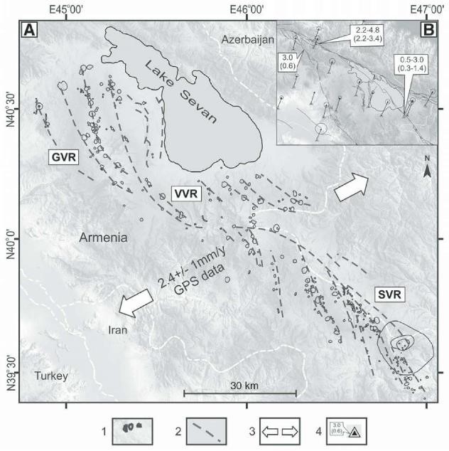
Figure 2.11. (A) Linear clusters of Quaternary and Holocene volcanoes bearing evidence of NE-SW extension. 1—Quaternary volcanoes; 2—linear clusters of volcanoes; 3—extension directions and velocities according to global positioning system (GPS) data (Davtyan, 2007); 4—horizontal slip rates from long-term geological data and GPS measurements (mm/yr), placed above and below in parentheses, respectively. (B) Slip-rate data from the geological and GPS data. GVR—Ghegam volcanic ridge; VVR—Vardenis volcanic ridge; SVR—Syunik volcanic ridge. (After Karakhanyan et al., 2017)
Sevan Peninsula and Sevanavank monastery
Sevanavank is a 9th century monastic complex located on a peninsula at the northwestern shore of Lake Sevan (Fig. 2.12). Sevanavank is a monastic complex located on a peninsula at the northwestern shore of Lake Sevan in the Gegharkunik Province of Armenia, not far from the town of Sevan. Initially the monastery was built at the southern shore of a small island. After the artificial draining of Lake Sevan, which started in mid-twentieth century during Soviet times, the water level fell about 20 meters, and the island transformed into a peninsula.
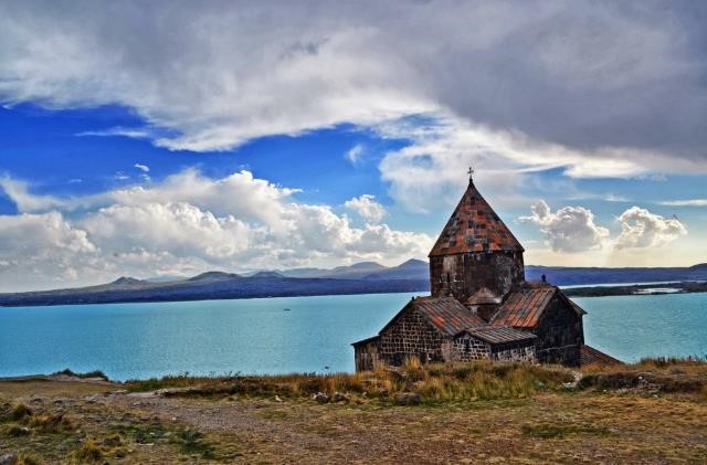
Figure 2.12. Sevanаvank monastery (9th century AD) on Sevan peninsula
According to an inscription in one of the churches, the monastery of Sevanavank was founded in 874 by Princess Mariam, the daughter of Ashot I (who became a king a decade later). At the time, Armenia was still struggling to free itself from Arab rule.
The two churches of the complex, Surp Arakelots meaning the “Holy Apostles” and Surp Astvatsatsin meaning the “Holy Mother of God”, are both similar cruciform plan structures with octagonal tambours. Adjacent are the ruins of a gavit whose roof was originally supported by six wooden columns. Some of the remains of the gavit and its columns can be seen in the Yerevan Museum of History. Reconstruction and restoration efforts took place from 1956 to 1957.
POST-CONFERENCE EXCURSION DAY 3, SEPTEMBER 11
- Khonarasar volcano split by an active fault
- Armaghan volcano
- Vayotssar volcano
- Return to Yerevan
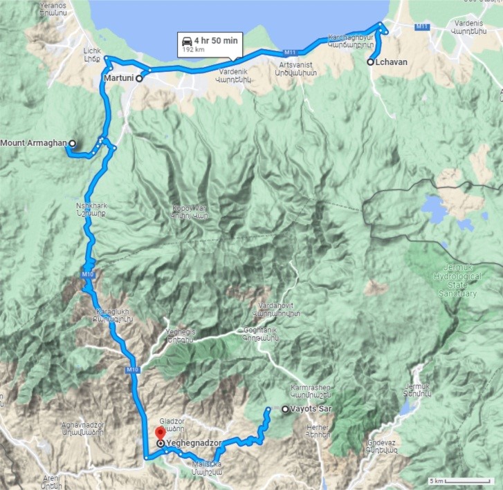
Figure 2.13. Post-conference trip route, day 3
Khonarassar volcano
Khonarhasar is located in Gegharkunik marz, about 2.5 km south of Lchavan village. Volcano represents unique site linked to volcanism and active tectonics. The Khonarhassar segment of the Pambak-Sevan-Sunik strike-slip fault splits and displaced Khonarasar volcano with offset up to 750 m, (Philip et al., 2017), figure 2.14. The minimum slip rate of the fault was estimated at 0.53 ± 0.04 mm/year over an interval of 1.4 Ma considering the age of Khonarhassar volcano is 1.4 Ma K/Ar age determination. (Philip et al., 2001).
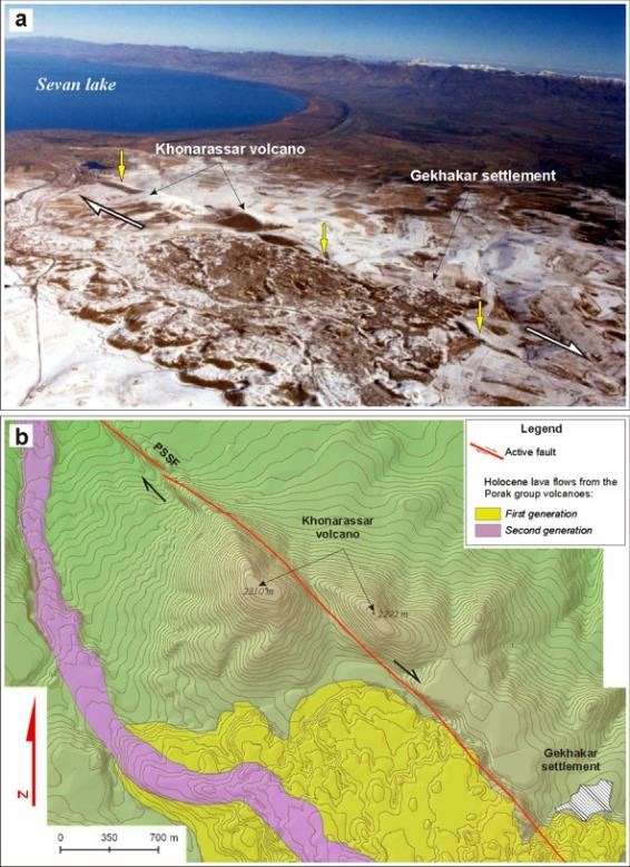
Figure 2.14. a) Aerial photo of Khonarassar volcano split and displaced by about 750 m. by fault b) simplified geological map of Khonarasar volcano.
Vayotssar volcano
Vayotssar is a large monogenetic volcano (cinder cone) that has been wonderfully preserved with a peak elevation of 2586.3 m (Fig. 2.15). The cone base diameter is 1600 m, and its relative height is 330 m. A funnel-shaped crater has been well preserved on the volcano summit and has a diameter of 500 m and the depth of 100 m. Crater walls are inclined 35° to the horizon. There are shallow vertical fractures on the volcanic body (linear erosion gullies, barrancoses) spreading from the crater to the base. The cone is mainly composed of scoria of lapilli dimensions. 40Ar/39Ar age determinations for lava flow of second generation yielded ~31 Ka. A few small open mines of scoria sand are present in the northern part of the volcano, which expose cinder stratification reflecting pulses of Strombolian explosive eruptions. Stepwise concentric gravitational terraces have developed on the cone slopes. The cinder cone and the described structural features are illustrated in Figures 3.3 and 3.4. Circumferential NW-SE oriented lava extrusions can be observed on the southwestern side of the cinder cone base (Fig. 2.16.). These lavas ultimately plugged the volcanic fissures that erupted late-stage lava flows The longer flow travelled up the Arpa River gorge and covered river terraces. The lava flow is traversed by the Malishka-Vaik section of the Yerevan-Meghri Highway, where it is possible to view the lava flow and its blocky nature. The Bronze Age to Middle ages settlement of Moz, situated on the margin of this lava flow, was destroyed by earthquake in 735 AD is. Armenian historian Movses Kaghankatvatsi (tenth century AD) writes: «Impenetrable darkness covered the Mozan region and the place shook for 40 days; thousands of people were buried alive under ground. This is why the place was called Vayots Dzor».
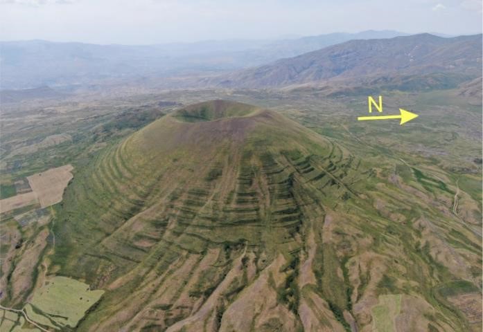
Figure 2.15. Vayotssar Volcano and vertical linear gullies (barrancoses) and step-wise gravitational concentric terraces.
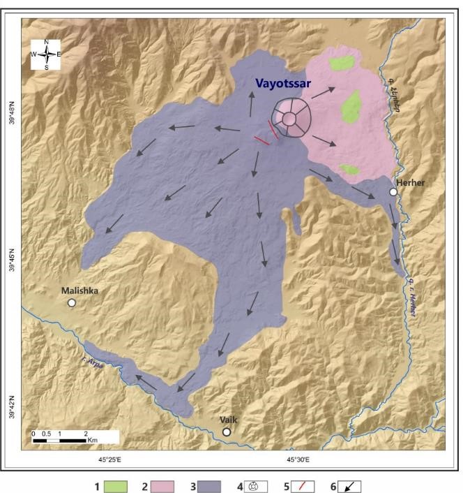
Figure. 2.16. Simplified geological map of Vayotssar volcano. Late stage of the Late Pleistocene: 1. Pyroclastic units; 2. Generation 1 of the trachybasaltic andesite lava; 3. Generation 2 of the trachybasaltic andesite lava; 4. Vayotssar cinder cone; 5. Volcanic fissures that ejected the lava; 6. Directions of lava flows.